Ecology
The landscape along the trail supports life that is unique to Minnesota. The diversity of terrain allows for a variety of environmental conditions and habitats. Slopes that face to the north along the 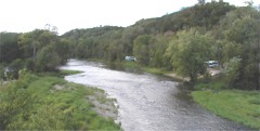 trail support species that could not tolerate the hot, dry conditions found on a terrace only a short distance away. To those that are excited about plant communities, rare plants, and colorful wildflowers, the Cannon River Valley offers years of exploration opportunities. In spite of some of the losses and abuses there are still several thousand acres of lands supporting ecologically significant natural communities as well as about 50 sites with rare plants.
Originally the Valley and immediate area was a contested zone between plant communities. The tall grass prairies prevailed on the uplands. North-facing slopes supported forests of maple and basswood. In between was often the oak savanna – widely spaced oaks with prairie grass and forbs underneath.
Remnants of these, and 7 other natural plant communities, remain along the Trail. A comprehensive biological survey, completed by the Minnesota Department of Natural Resources in 1993, found that 7% of the county could still be classified as a functional unit of one of 17 original natural communities. Much of this remaining natural area is along the Cannon and Mississippi Rivers.
The valley is an important place for two endangered plant species as well as other plants that are threatened or of special concern. The endangered species are: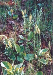
Kittentails (besseya bullii) and Minnesota Dwarf Trout Lily (erythronium propullans). Kittentails are classified as state endangered and were considered extremely rare in Minnesota until discovered by the dozens in the Valley. 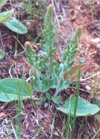 The discoveries were made both by Cannon Valley Trail and the County Biological Survey. The plant features an attractive yellow flower stalk in late spring to early summer with large oval shaped leaves. The leaves remain conspicuous most of the year. The plant is found as far east as Indiana and north to Michigan but is not common anywhere.
 The Minnesota Dwarf Trout Lily is one of Minnesota’s two endemic plant species, meaning it is found within the borders of the state and nowhere else. It is known from only three counties within the Cannon River watershed.
 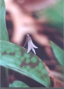 The population in the lower Cannon River Valley is the most north and easterly known and was only discovered in 1991. The lily is classified as federally endangered and inhabits mature maple basswood forest near rivers. It has very small trout lily like flowers that bloom in late April. The plant is nearly impossible to distinguish from the common Trout Lilies after the blooms have dropped. By late summer the leaves have died back and almost nothing is left to look at above ground.
 White-Tailed Deer
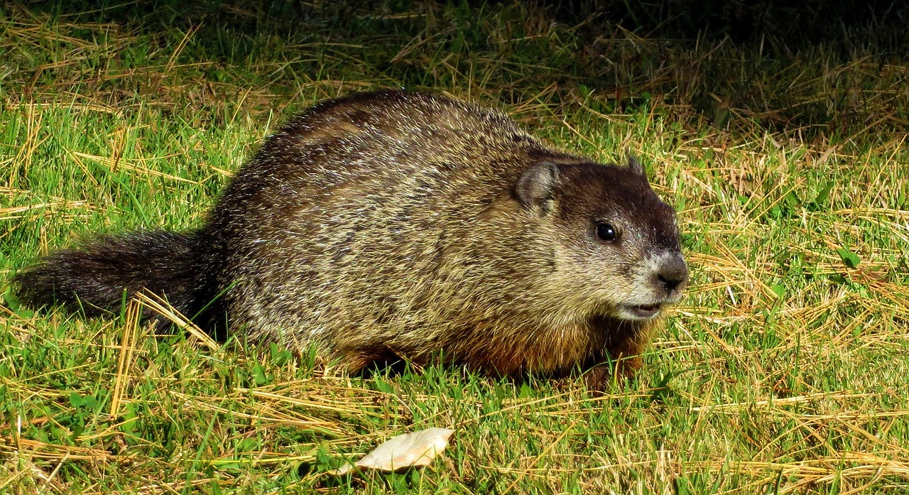
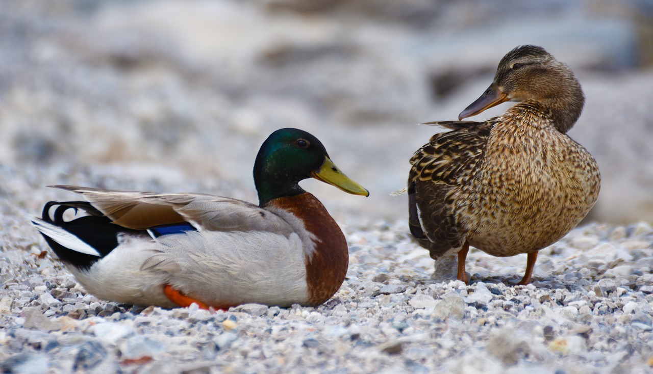
To patient and trained observers, the valley is likely to be a place of memorable wildlife encounters. It would take pages to list the 47 species of mammals, 41 reptiles and amphibians, 229 regularly observed birds, and 76 species of irregularly observed birds known to southeastern Minnesota.
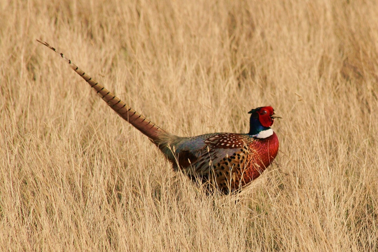
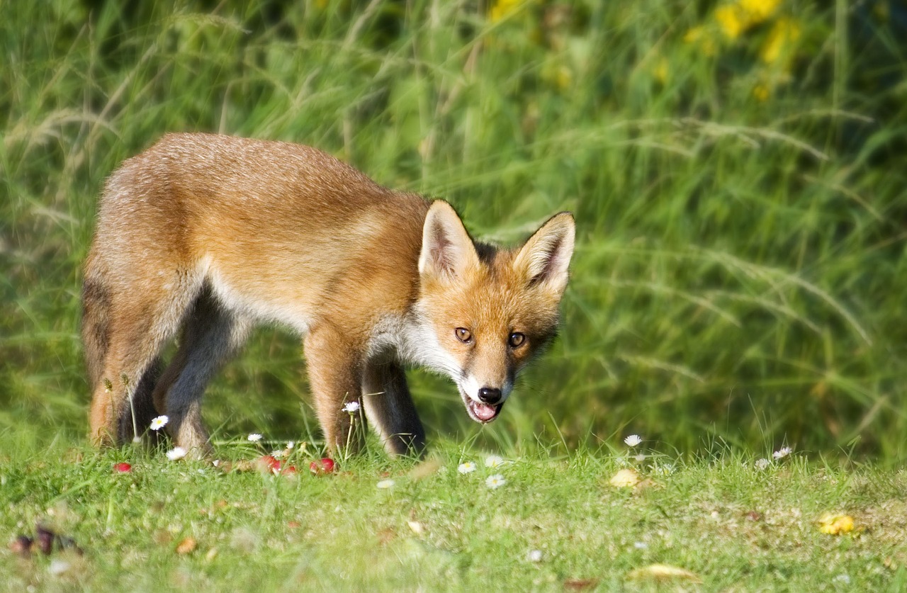
Before European settlement, the Valley and region supported wildlife uncommon to nonexistent today. Large mammals such as elk, bison, bear, and wolf were common. Peregrine falcons and golden eagles nested. The river itself supported over 50 species of fish. In spite of intensive settlement, a surprising number of the original inhabitants remain. While today there are no free roaming bison, and only an occasional bear and peregrine falcon, species such as bobcat, fox, deer, and bald eagles, are increasingly common.
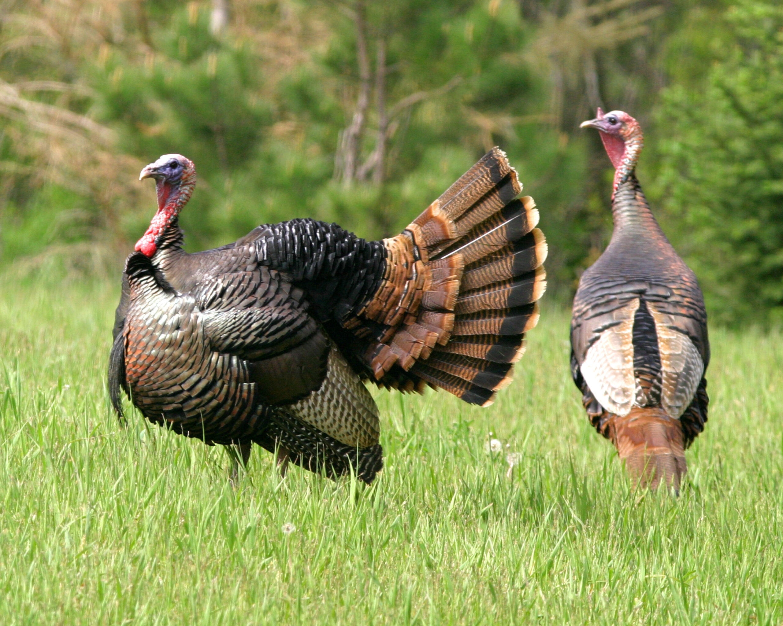
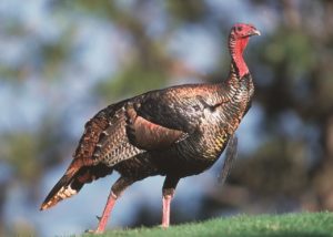 Wild Turkey
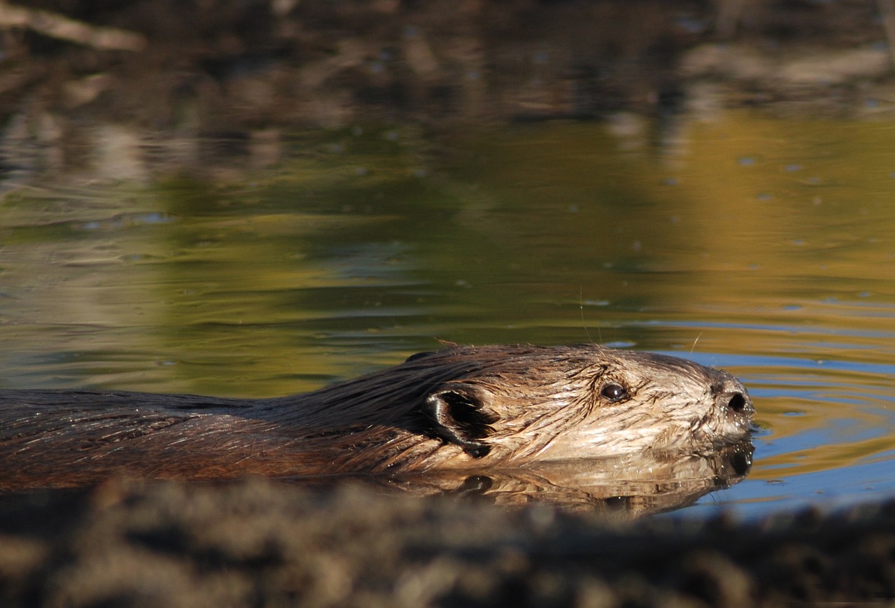
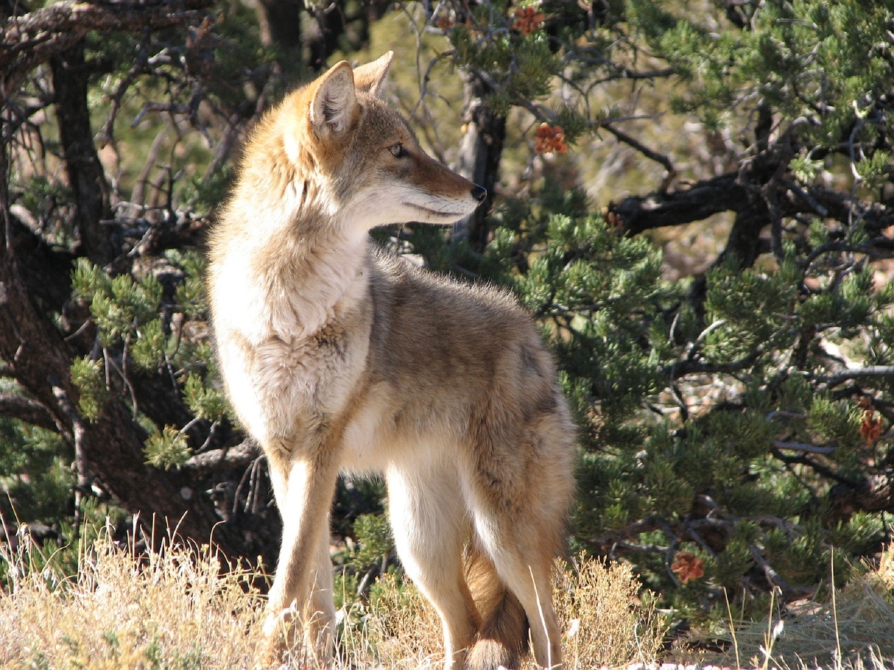
Other species you may commonly see are wild turkeys, beavers, and coyotes. Coyotes are seldom seen but are commonly heard yipping in the morning. From late winter to early summer, listen for a distant thumping noise, almost sounding like a tractor engine. It could be a male grouse drumming to attract a female. Drumming is accomplished by rapid wing beats, sometimes amplified by standing on a hollow log. Grouse are fairly common but not that prevalent in the Valley.
 Turkey Vulture
There are many other species of special interest in the valley such as opossum, gray tree frogs, turkey vultures, whip-poor-wills, pileated woodpeckers, bluebirds, and even a very occasional migrant black bear or moose. Also found are several species of particular interest mainly because of their rarity both locally and in their ranges. You may encounter some of them.
An osprey has been sighted three years in a row now near Welch. They once nested throughout the state but now occur only rarely in southern Minnesota. They are fish eaters and nest in huge trees or man-made structures near water feeding areas.
Timber rattlesnakes are not something you have to worry about. Excessive harassment, deliberate habitat destruction, and the invasion of woody vegetation on cliff faces has reduced this once common valley inhabitant to only one known site. This site is far from any place commonly visited. There are frequent snake sightings on Cannon Valley Trail but never the timber rattlesnake (so far!!).
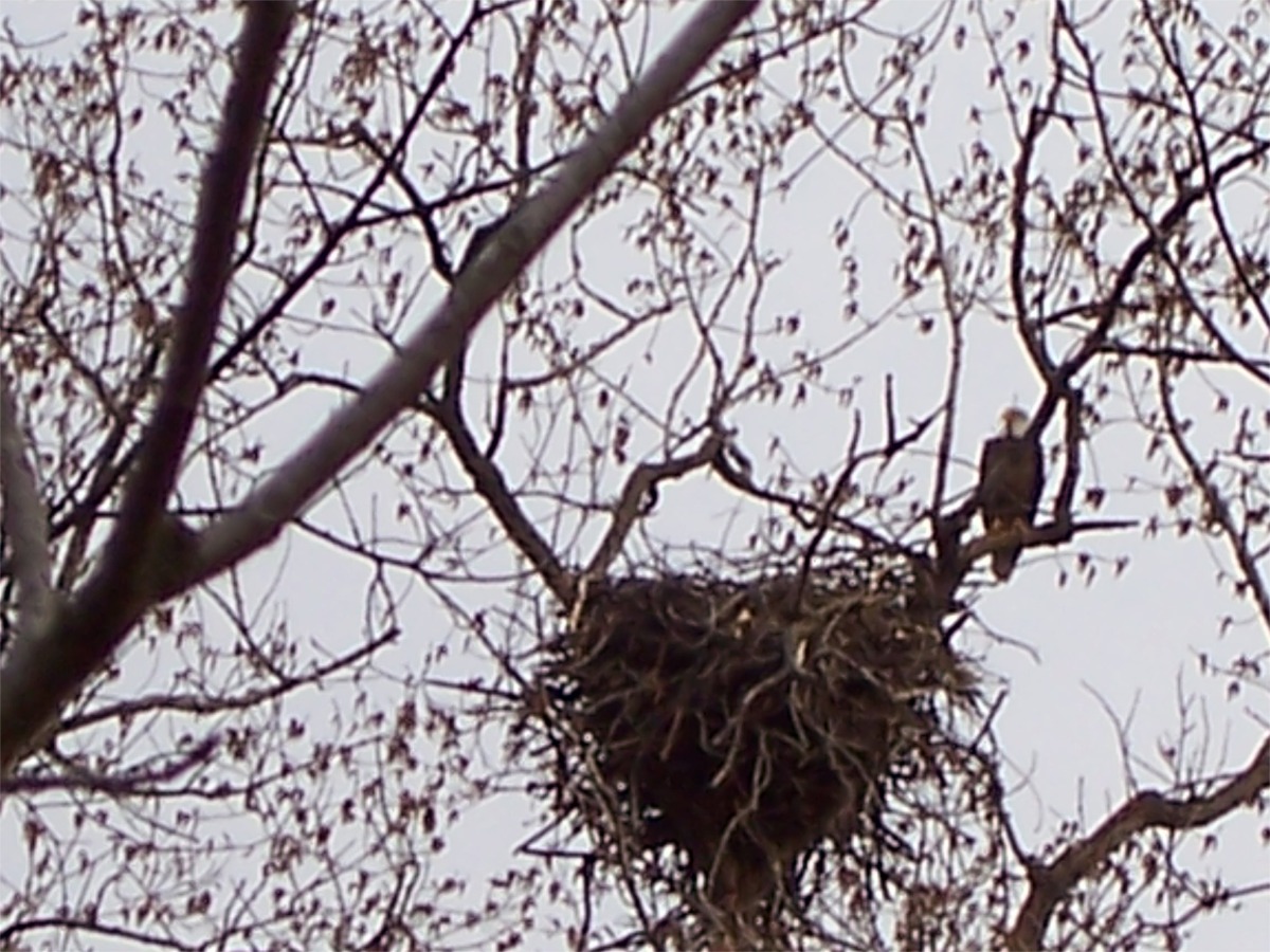
 Bald Eagle
Bald Eagles can be seen almost any month of the year in the valley as they are now nesting along the Mississippi River near the mouth of the Cannon. Wood turtles you’re not likely to see as they are so rare. It has been suggested that the loss of even one female turtle of reproductive age from the valley may spell doom for the local population. They are found elsewhere in Minnesota and other states.


Geology
The geological record dates back billions of years as volcanic activity, ancient seas, and the continental drift created and destroyed landscapes. Within these cycles, the sandstone and limestone bedrock present today was created and eventually uplifted. But the latest ice ages, beginning about 1.6 million years ago, are most responsible for shaping the Valley we enjoy today.
The trail runs along several stretches where weathered and overgrown outcrops provide glimpses into the ancient seas, which once covered the area 500-600 million years ago. Many of you may not be aware but if the present is the key to the past than this part of Minnesota was tropical, near shore, marine, shallow, (tens of feet deep) and dotted with shoals and low lying islands. Many of the creatures on the bottom would be familiar including the snails and clams but some such as brachiopods and crinoids are only familiar to oceanographers who explore the deeper parts of today’s oceans.
There were four major advances of continental sized ice sheets which covered most of North America. There were some warm periods here and there also. The last time Minnesota was partially covered with ice was about 10,000 –12,000 years ago. Present day trends are a little difficult to interpret but there are some good arguments on both sides of this question: Are we between advances of glaciations or are the ice ages totally over? I don’t know about you but I sure hope it’s over, but no one knows the answer so the arguments will continue for a long time or until we are of course, covered with ice.
Along the trail are several gravel pits. Close inspection of the gravel reveals many rock types, which are not found in outcrop anywhere nearby. The pebbles and cobbles include intrusive and extrusive igneous rock type, metamorphic rocks, and sedimentary rocks. If you want to see igneous and metamorphic rocks in out crop, you have to travel at least as far north as Taylors Falls, Minnesota. The sands are composed of tiny rock fragments as well as single grains of quartz, feldspar, and other durable minerals. There are beds of clay and silt, separate beds of sand with few pebbles and still other beds with large amounts of course sand and pebbles. The ability of flowing water to transport materials depends upon the depth and velocity of the water. Experiments long ago showed that if the water velocity doubles then the diameter of the particle which can be carried along the bottom may increase by as much as a factor of 64! Rivers flowing in high velocities can roll sizeable boulders along the bottom of the channel. At low velocities rivers push and shove only sand-sized grains, but at higher velocities they roll large cobbles along the bottom. Silt and clay are carried in the gentlest of currents and only in backwaters and abandoned flood channels will these small sizes settle out on the bottom. The sand and gravel exposed in pits along the trail are remnants of glacier fed floods, which ran down the valet at the end of the ice age. There were no European weeds, in fact the easiest way to date the invasion of Minnesota by Europeans is to look for ragweed pollen in cores extracted from Marshes.
The Cannon River is a commending presence for humans, aquatic animals, migrating birds, terrestrial animals and plant life found in the valley. At many different times the river is sparkling clean, or a chocolaty brown, filled with canoeists and inner tube users, snow and ice and rampaging flood waters. Measurement of the water quality is an index of the health of the region it drains. The amount of water flowing down the river determines whether it is a threat to us or a source of health and pleasure. Archaeologists tell us that the banks of the Cannon have been occupied for many, many years. We have been actively modifying the river and valley since the mid 1800’s. Long term statistics show that the river reaches bank full stages about once every 2.3 years. Waters spilling out of the channel carries fine sand and silt which have built a flood plain. Soils in the flood plains are excellent for crops because they are naturally fertile but the floods are also always a threat to destroy the crops. Pools and riffles in the channel of the river provide different habitats. Rivers like the Cannon, which flow over sands and gravels are usually divided into a succession of riffles (shallow, fast moving sections) and pools. Riffles are important places for aquatic insect production because the cobbles make a good place for larvae to attach and the oxygen content of the water flowing past them may be slightly higher because of the turbulence.
Pools spaced between the riffles are deeper, darker, and quieter. People fishing the river often look for pools because fish are often found at the upstream ends searching for insects and other food swept out of the riffles.
Starting at Mile Post 88 the Cannon River begins to encounter the effect of the great Mississippi Valley. Canoeists discover that the river begins to split into smaller distributary channels, and the much widened valley becomes filled with a major marsh. Through this reach of the river the cannel slope is so flat that sediment tends to accumulate and produce a delta-like deposit. So much sediment has been carried down the Cannon that it has shoved the Mississippi across its own channel to the Wisconsin side of the valley. All the major tributaries to the Mississippi back and forth across its valley.
The major course of the Cannon River has been inherited from post-glacial times, but its present condition is very much a product of human intervention. The Minnesota Pollution Control Agency would like to see the river meet its 2B standards: “The quality of this class of the intrastate waters of the state shall be such as to permit the propagation and maintenance of cool or warm-water sport or commercial fishing and be suitable for aquatic recreation of all kinds, including bathing, for which the waters may be usable.
The Cannon River watershed is quite extensive covering much of Steele and Rice counties and touching on Waseca, Le Sueur, Scott, Dakota, and Goodhue. A watershed is delineated by drawing a boundary around all the lands that drain into the river. The highest point in the watershed is about 400 meters above sea level south of Owatonna and the lowest point is at the confluence with the Mississippi at about 200 meters above sea level.
The April 1965 flood was brought on by a combination of heavy rains and rapidly melting snow. The flood was so large that hydro geologists have a difficult time establishing the frequency of such a large-scale flood. It was more than twice as large as any other flood which has been recorded on the Cannon, and that makes it difficult to say how often we ought to expect floods of such magnitude. It may be that this was a once in 500-year occurrence. If it were not for the lakes in the upper parts of the basin, floods would recur more often and be larger in magnitude.
According to the records, the river has flooded in every month of the year except for November. The Cannon responds rather dramatically to rainfall, especially the torrential downpours which often accompany spring and summer thundershowers. Rising several feet in a few hours following one of these storms it can quickly become a treacherous, uncontrollable deluge. If the ground is well soaked form earlier storms little water infiltrates downward and a much larger percentage of the rainfall becomes runoff. During a particularly cold winter there will be many weeks when no overland flow reaches the river at all. Snow cover, frozen ground, and low temperatures mean that little liquid water is available at the surface of the ground. During winter cold snaps the only water reaching the river comes from underground. It is especially clean and pure and is evidence that contamination during the warmer periods of the year comes from the land surface itself.
Chemical and biological analyses of the river indicate that it is rich in calcium, magnesium, and bicarbonates. Just as we might suspect, these come from waters draining the limestone and dolostone bedrock.
There are also fairly high concentrations of nitrates and sulfates which are indicative of farmland runoff. Although there are few measurements of the suspended sediment load it is clear to a serious observer that the river turns brown following hard rains or the spring melt. Sediment comes from farm fields, barnyards, and construction areas rather than from the banks and bottom of the river.
Cities and towns along the Cannon discharge waste water into the Cannon, and provided their treatment plants are efficient and large enough they will not harm the river. However, with growing populations both Faribault and Northfield have had to invest large sums of money in expanding modern sewage treatment facilities.
The Trail provides us with a journey to the past. Written in the rock is a dynamic story of oceans and glaciers, and torrents of melt water. It has taken a half billion years to write the story, and we are only just now beginning to read and understand it.
